5.2.1. Create OcTree Mesh
Here, the code create_octree_mesh_dcip.exe and the input file octree_mesh.inp (see format) are used to create an OcTree mesh based on the set of electrode locations and surface topography. Files relevant to this part of the example are in the sub-folder octree_mesh.
Before running this example, you may want to do the following:
For our example, the survey file uses the general format . This means the survey file has elevations for the electrodes (the example file just has columns of zeros). Please be aware that the true electrode locations at the surface may live above the discrete surface topography defined by the mesh and its active cells model. To ensure you do not model any surface electrodes as living in the air, use the data_Z.txt file output by create_octree_mesh_dcip.exe when doing subsequent forward modeling.
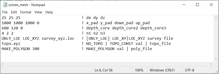
To generate the OcTree mesh, the following input file was used:
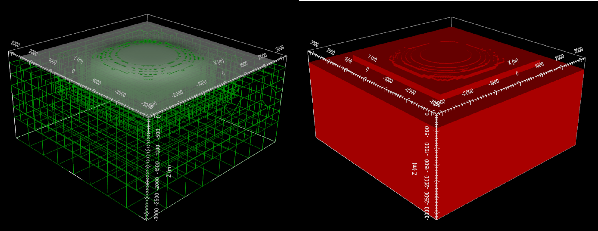
Below we plot the resulting OcTree mesh and original topography (left) as well as the active cells model (right). The active cells model defines the discrete surface topography by assigning a 1 to cells that are in the ground and a 0 to cells that are in the air.